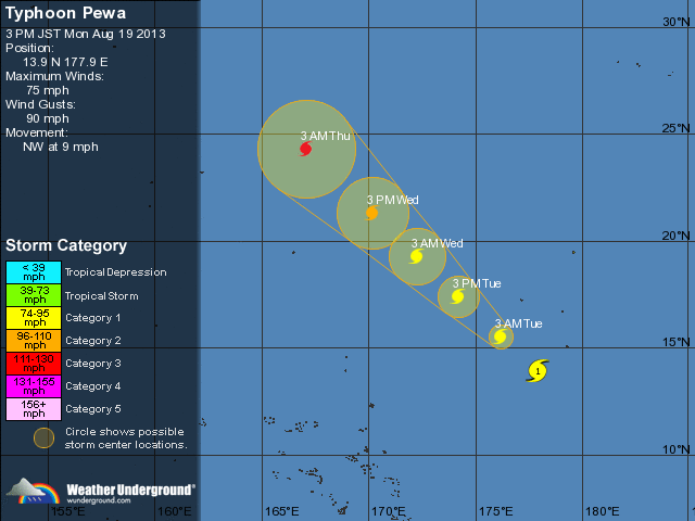
Om 1500 UTC lag het centrum van tropische storm Pewa op 1995 km ten zuidwesten van Lihue (Hawaiï). Pewa trekt naar het west-noordwesten met een snelheid van 20 km/h. De gemiddelde windsnelheid bedraagt 65 km/h met zwaardere windstoten.


© onweer-online
Bron: Wunderground, NOAA
summary of 500 PM HST...0300 UTC...information
----------------------------------------------
location...10.1n 175.4w
about 1340 mi...2160 km SW of Lihue Hawaii
about 605 mi...970 km SW of Johnston Island
maximum sustained winds...50 mph...85 km/h
present movement...WNW or 290 degrees at 13 mph...20 km/h
minimum central pressure...1004 mb...29.65 inches


summary of 500 PM HST...0300 UTC...information
----------------------------------------------
location...11.8n 179.5w
about 1065 mi...1715 km ESE of Wake Island
about 700 mi...1125 km ENE of Majuro atoll
maximum sustained winds...65 mph...100 km/h
present movement...WNW or 300 degrees at 13 mph...20 km/h
minimum central pressure...1000 mb...29.53 inches


Bron: Wunderground
- Center position N14°00'(14.0°) E178°00'(178.0°)
- Direction and speed of movement NW 15km/h(8kt)
- Central pressure 990hPa
- Maximum wind speed near the center 30m/s(55kt)
- Maximum wind gust speed 40m/s(80kt)
- Area of 50kt winds or more ALL40km(20NM)
- Area of 30kt winds or more ALL170km(90NM)


© onweer-online
Bron: NOAA, Wunderground, JMA
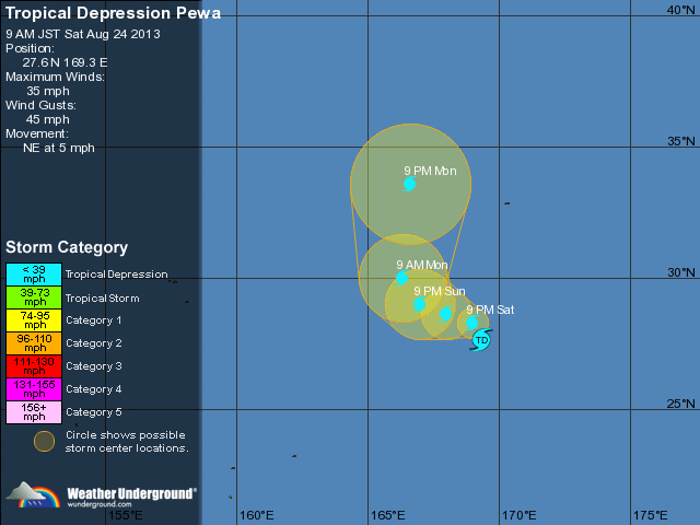
- Direction and speed of movement NW 15km/h(9kt)
- Central pressure 996hPa
- Maximum wind speed near the center 20m/s(40kt)
- Maximum wind gust speed 30m/s(60kt)
- Area of 30kt winds or more N170km(90NM) / S130km(70NM)


Bron: JMA, Wunderground

 Berichtgeving TC Pewa (Pacific)


