nicole poulette @nicolechicken
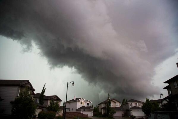
The view from the office. #ominous #abstorm #yeg
Suzanne Leonard @SuzanneTWN
#Tornado warning continues for #Edmonton area STAY ALERT. RT @SPA515_Prof Southwest #YEG 10 min ago, now in basement

Hilary__Clark Hilary 24s
Glad I'm not flying today! #tornado #pigeonlake pic.twitter.com/AfFSgRjNDS
Ashley Neufeld @Ashley_Neufeld
Welcome to Alberta #tornado #scary #workoutside #pigeonlake

Denise Henwood @DeniseHenwood
“@weathernetwork: Clearly defined wall cloud. Dangerous storm! #abstorm #twn RT @derek_allen South of #yeg

Tami Paul @tamazene_marie
About a half hour ago. South Edmonton #abstorm #yeg #weather
Weet iemand waar de #yeg voor staat? | Gewijzigd: 12 juni 2013, 23:31 uur, door Marga
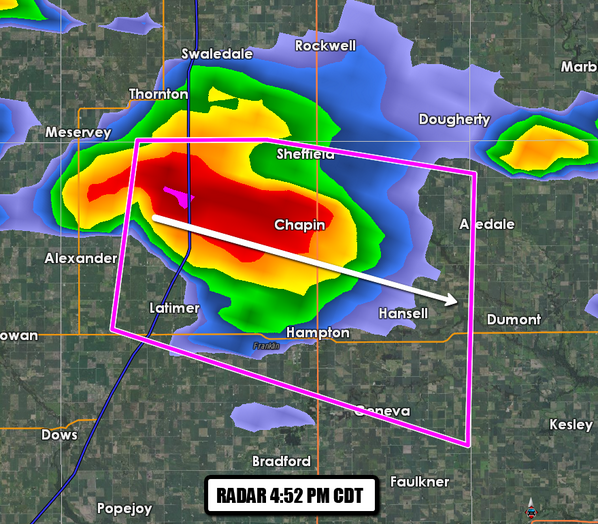
4:22pm CDT - A confirmed #tornado near Belmond in north-central Iowa moving E at 20 mph.


@JoeyStormChaser: CONFIRMED tornado on this cell near Belmond, Iowa! Heading SE towards Alexander! TAKE COVER NOW
TWC Breaking @TWCBreaking
4:36pm CDT - Spotters continue to confirm a tornado on the ground 8 mi E of Belmond, IA moving E at 30 mph into Franklin County, IA. | Gewijzigd: 12 juni 2013, 23:42 uur, door Marga
Onweer 2015: 14x
Onweer 2016: 10x
Onweer 2017: 12x
Onweer 2018: 14x
Onweer 2019: 15x
Onweer 2020: 8x
Onweer 2021: 11x
Onweer 2022: Niet bijgehouden
Onweer 2023: 20x
Onweer 2024: 10x 31-3 een paar flinke flitsen en donders, 15-4 3 donders, 30-4 donders en bliksems in de verte. 2-5 flinke donders en bliksem 19-5 uren lang gerommel, uiteindelijk een paar flinke donders. 21-5 Een aantal lekkere donders. 26-5 donders 9-7: matig, zware donders 23-7 vele zware diepe ' bass' donders 7-8 Een diepe donder

Josh Cummins @josh_cummins94
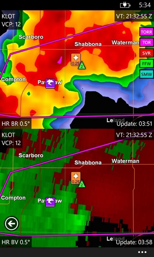
This isn't good! Radar is showing non-spherical items (debris aloft) near Paw Paw, Illinois! #ILwx
Eric Fisher @EricFisherTWC
This storm east of Paw Paw, IL has hook echo and strong rotation. Possible #tornado. 4:36 CDT | Gewijzigd: 12 juni 2013, 23:38 uur, door Marga
@stormchaser4850
Developing: Multiple reports of a tornado on the ground in Franklin Co., Iowa in the Hampton area (4:33-4:42 pm CDT)
@thestormreport: Spotters tracking a #tornado on the ground 5 miles to the NW of Latimer, Iowa. "Debris cloud is visible.
 | Gewijzigd: 12 juni 2013, 23:55 uur, door Marga
@EricFisherTWC
Observed tornado in DeKalk Co. Illinois - AT 456 PM CDT...A CONFIRMED TORNADO WAS LOCATED NEAR SOMONAUK...AND MOVING EAST AT 30 MPH.
Bryce Kintigh @stormchasrbryce
#Confirmed #tornado on the ground at 4:56 pm near Somonauk, IL. Storm is moving toward Aurora, IL & Chicago metro! Be weather-aware! | Gewijzigd: 13 juni 2013, 00:02 uur, door Marga
Gepubliceerd op 12 jun 2013
Short clips of 5 different funnels that formed from the stalled cell by Belmond, IA. Shows progression from west to east and dissimilation and re-assimilation of the funnel as it worked eastward. Funnels diverged with one up to Sheffield and the another over Hampton picture of those are on media Facebook Pages. Additional Clips will be posted on http://StormCore.Info/ showing the actual development of the funnels from the cloud to the ground in specific footage. This was not a super cell or sever cell prior to the tornadic activity. The conditions regarding this phenomena and how it influences assimilatory conditions are a different matter and will be divulged and extrapolated on the website at a future time.
This footage is © property of StormCore.Info and Fready Frank Toemay

A dark ominous cloud forms over the west-end of Edmonton at 2:34pm during a Tornado watch that was issued for Edmonton and surrounding communities on Wednesday June 12, 2013. The photo was taken from 111 St., and Anthony Henday looking west. Tom Braid/Edmonton Sun/QMI Agency

A dark ominous cloud forms over the west-end of Edmonton at 2:34pm during a Tornado watch that was issued for Edmonton and surrounding communities on Wednesday June 12, 2013. The photo was taken from 111 St., and Anthony Henday looking west. Tom Braid/Edmonton Sun/QMI Agency

A dark ominous cloud forms over the south side of Edmonton shortly around 3pm during a Tornado watch that was issued for Edmonton and surrounding communities on Wednesday June 12, 2013. The photo was taken on Whitemud Drive southbound near the Anthony Henday turn off. Angelique Rodrigues/Edmonton Sun/QMI Agency

A dark ominous cloud forms over the north side of Edmonton around 3pm during a tornado watch that was issued for Edmonton and surrounding communities on Wednesday June 12, 2013. The photo was taken from a home near 68 Ave., and 82 St., looking east. Edmonton Sun Reader Photo
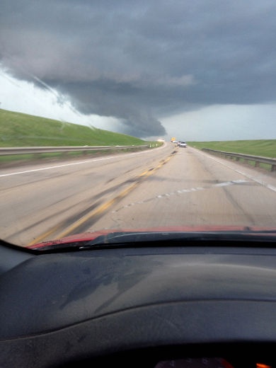
Ominous storm clouds 10 minutes east of Devon around 2 p.m. on Wednesday, June 11, 2013. A tornado warning was issued for the area. Hail, high winds and rain pounded the area. BOBBY ROY/LEDUC REP/QMI AGENCY

Ominous storm clouds roll in Devon around 2 p.m. on Wednesday, June 12. A tornado warning was issued by Environment Canada for the area. High winds, hail and rain pounded Devon for 20 minutes. BOBBY ROY/LEDUC REP/QMI AGENCY

A funnel cloud gathers over Nisku, Alta., during a tornado watch that was issued in central Alberta on Wednesday, June 12, 2013. Heavy rain and hail fell in the region but there were no reports of any tornadoes touching downs. Tim Sacrey/Edmonton Sun Reader Photo

Traffic makes its way through a huge puddle under the train underpass along 63 Avenue near 99 Street, as a severe storm moved over the Edmonton, Alta. area on Wednesday June 12, 2013. David Bloom/Edmonton Sun/QMI Agency

Leduc resident Andy Buhler took this photo in the Bridgeport area of Leduc on Wednesday, June 12, 2013. Andy Buhler\Leduc Rep\Edmonton Sun\QMI Agency

A man driving a pick-up truck makes his way through a merge lane on 106 St., just south of Whitemud Drive during a tornado watch that was issued for Edmonton and surrounding communities on Wednesday June 12, 2013. Tom Braid/Edmonton Sun/QMI Agency

Submitted photos of a storm gathering over Leduc, Alta. on Wednesday, June 12, 2013. Leduc Rep\Edmonton Sun\QMI Agency

Traffic makes its way through a huge puddle under the train underpass along 63 Avenue near 99 Street, as a severe storm moved over the Edmonton, Alta. area on Wednesday June 12, 2013. David Bloom/Edmonton Sun/QMI Agency
Bron: Edmontonsun
Abilene Machine in Belmond, Iowa.
Cattleman's Restaurant and Provisions damaged during storm in Belmond.
"1 mile from Belmond"
Two tornadoes near Hampton on June 12
Tornado near Belmond, Iowa.
Tornado near Belmond, Iowa.
Tornado near Hampton, June 12.
Belmond, Iowa, tornado on June 12
Tornado near Belmond, Iowa, on June 12.
"Picture was taken 1 mile south of Coulter at 4:40 looking to the northwest. It appeared to be about 5 miles away," said Steven Kaufman
Bron: KCCI
| Gewijzigd: 15 februari 2017, 11:16 uur, door Joyce.s

Barb Sanders shared this picture taken Wednesday afternoon in Hinckley about 60 miles west of Chicago. Thanks Barb!

Photo by Tiffany Carroll

Photo by Rich Wilke
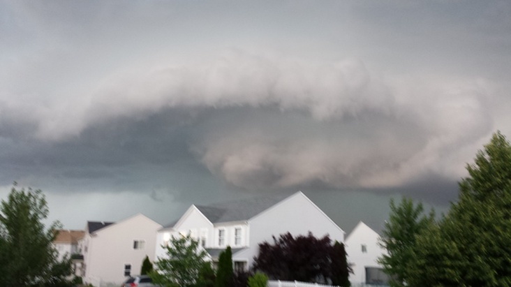
Photo by Jason Lupo
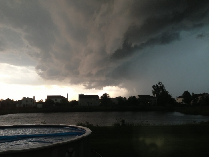
Photo by Bob Husanik

Photo by Red Bagger

Photo by Vittorio Gensini and Dr. Walker Ashley

Photo by J. Smith
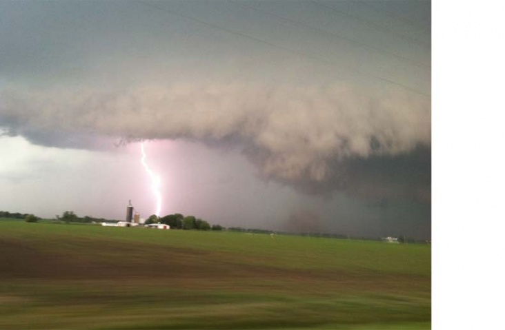
From Ray Gleason, Montgomery IL

Photo courtesy of JoePudlik

Photo courtesy of Andra Olson

Photo courtesy of Erik Tuttle
Bron: Chicagoweathercenter

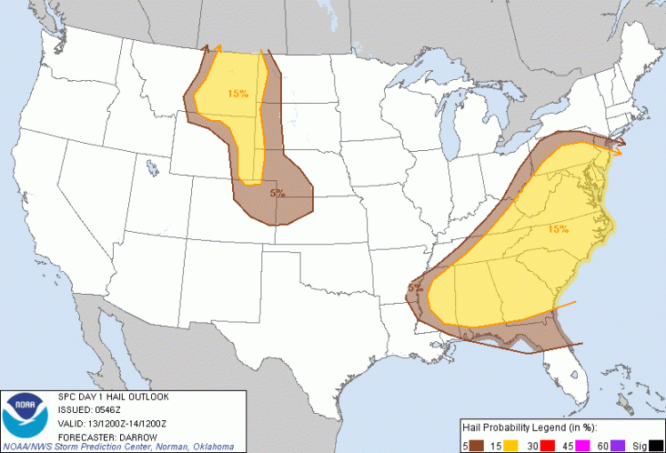
 Extreem weer USA: 11-12-13 juni 2013, derecho mogelijk


 | Gewijzigd: 13 juni 2013, 00:08 uur, door Frans24


