Facebook: US National Weather Service Norman Oklahoma
Using GIS, we have estimated that around 13,500 people were in the direct damage path of the Newcastle/Moore EF-5 tornado. This data comes from the LandScan Population model for the south Oklahoma City Metro.

Facebook: US National Weather Service Norman Oklahoma
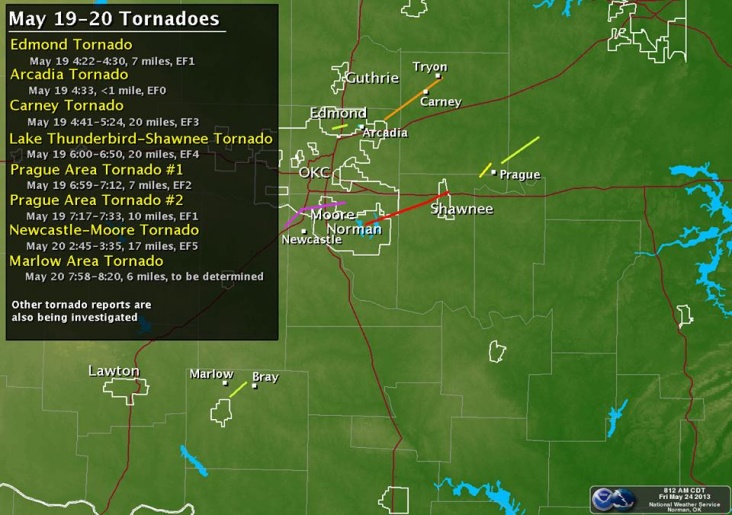
Here's a preliminary tornado track and intensity map from May 19th and 20th. More details will be coming over the next week as we continue to sort through damage surveys. Thanks for your patience.

NWS San Angelo @NWSSanAngelo
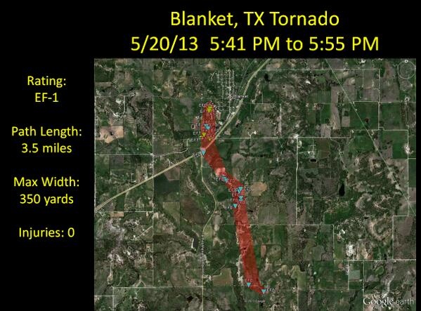
The 5/20/13 Blanket #tornado path per the NWS damage survey. This tornado was rated EF-1.

NWS San Angelo @NWSSanAngelo
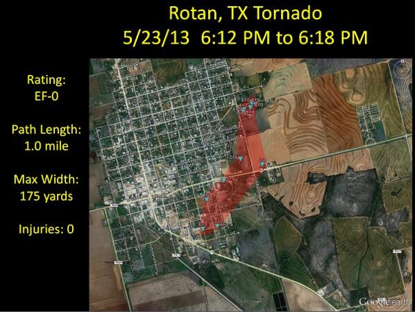
The 5/23/13 Rotan #tornado path per the NWS damage survey. This tornado was rated EF-0 | Gewijzigd: 25 mei 2013, 18:41 uur, door Marga
News9 heeft de bewakingsbeelden van de Southgate Baptist Church tijdens de Moore tornado. De beelden laten de tornado vanuit verschillende hoeken zien. De kerk ontsnapte op een nippertje aan een voltreffer van de tornado. Jackie Martin, lid van de kerk, heeft er twee maanden over gedaan om de video te herstellen. De camera's hebben een back-up batterij, zodat ze bleven filmen, nadat alle stroom was uitgevallen.
©onweer-online
Bron: News9 | Gewijzigd: 9 augustus 2013, 21:03 uur, door Marga

 Tornado-uitbraak USA 18-23 mei 2013 (Shawnee en Moore tornado's)


