Tornado Titans - Extreme Weather and Storm Chasing
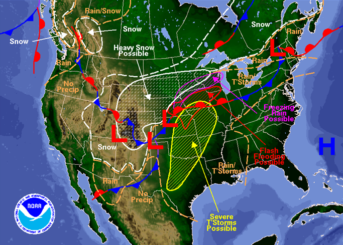
Cold front continues to go south and east at a pretty good clip. It's pretty easy to spot in this satellite image. All storms that form along the cold front should immediately be in the cold air, which should almost eliminate most tornado probabilities for all storms on the cold front. The dryline *could* light up with a storm or two south of the front, that is the biggest source of a tornado risk. Right now the dryline looks to intersect the cold front somewhere South-ish of Wichita Falls later this afternoon, subject to change. Winter weather advisories are going into effect for much of the region as well, as the quicker frontal passage will likely mean some sleet and freezing rain overnight as the main system ejects out over the area.

SPC
Schade van een van de tornado's in Benkelman, Nebraska op een boerderij.

File image from MyPrairieRoots.com

Bron: Tornado Titans

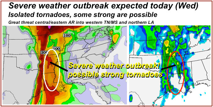
But for Wednesday in central/eastern AR, southern MO, western TN/MS, much of LA ahead of a stalling cold front supercells and tornadoes are a strong possibility..
We'll be heading E for this lower MS River event leaving very early in the morning. Storms should initiation in central/southern AR by early afternoon with bands of supercells and/or bow echoes through evening to across the MS River. Stay tuned for morning model runs because they have been very unreliable so far.
Bron: Reed timmer

Vandaag nieuwe kansen.


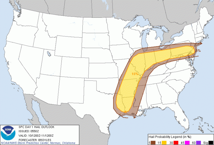
Kaarten: SPC | Gewijzigd: 10 april 2013, 09:48 uur, door Ries
In Doge County zijn twee mensen die aan het werk waren geraakt door bliksem. Volgens de locale sherrif was 1 man binnen aan het werk en is ongedeerd gebleven maar de andere man die buiten was is met onbekend letsel naar een ziekenhuis gebracht.
WISN
Zware onweersbuien ontstonden dinsdagavond in delen van Texas, Oklahoma, Kansas en Missouri toen een dynamisch stormsysteem over de Plains trok. Vanaf 2.00 pm CDT variërden de temperaturen van 8F in Cheyenne (Wyoming) tot 102F in Laredo (Texas). Een botsing tussen deze luchtlagen zal het strijdtoneel zijn van zware buien. Dallas, Oklahoma City, Wichita en Kansas City lagen in de vuurlinie. De buien waren in staat om grote hagelstenen te produceren.
REPORTS:
- 7:45 a.m. CDT Wednesday: Multiple trucks were blown over on a highway about 50 miles west of Chicago, do to strong thunderstorm winds. Wind gusts of 55 mph were observed near De Kalb, Ill.
- 12:55 a.m. CDT Wednesday: A severe storm moved through Comanche County, Oregon bringing hail up to 1 inch in diameter and wind gusts up to 55 mph.
- 11:19 p.m. CDT Tuesday: Hail up to M&M sized (0.5 inch in diameter) was reported with a thunderstorm that pushed through Monroe County in western Wisconsin.
- 10:30 p.m. CDT Tuesday: Reports of heavy rain came in from just east of Sioux Rapids, Iowa where more than 2.75 inches of rain has fallen from the storm.
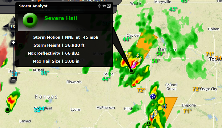
- 9:55 p.m. CDT Tuesday: A severe thunderstorm moved through Kansas City, bringing hail that ranged in size from pennies to quarters.
- 8:235 p.m. CDT Tuesday: As a strong thunderstorm approached the Omaha, Nebraska area, the storm produced hail ranging from 1 to 2 inches in diameter across Douglas County.
- 7:45 p.m. CDT Tuesday: A tornado was reported to have taken down a power line in Fenton, Iowa
- 7:30 p.m. CDT Tuesday: A severe thunderstorm moved from the city of Elbert through just east of Archer City in north-central Texas. This storm produced 2 inch diameter hail in Elbert County and hail up to baseball size south of Archer City.
- 6:50 p.m. CDT Tuesday: Wind and 1 inch hail broke the windows in a police car near Humboldt, Neb.
Bron: Accuweather

 Extreem weer USA: 6-11 april


