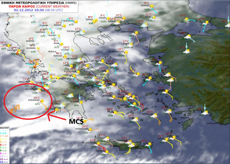
A level 1 was issued for the E-Aegean Sea and W/NW Turkey mainly for heavy rain, isolated large hail, strong wind gusts and an isolated tornado event.
SYNOPSIS
The big trough is comfortable over Europe and brings cold and unsettled conditions to many parts. Weak ridging extends into parts of extreme NW Europe wich does not mean that stable conditions exist as fronts move in from the west.
DISCUSSION
... Aegean Sea and W-Turkey ...
Weak surface cold front dissolves over the Aegean Sea beneath strong southwesterlies, which keep the DLS enhanced (15-20 m/s). Prefrontal moist and warm air mass surges towards the W-coast of Turkey and keeps MLCAPE in the 500-1000 J/kg range over the E-Aegean Sea. Therefore, repeatedly onshore moving showers and thunderstorms are forecast, which might produce heavy rain, although no real focus is seen for training activity. Isolated large hail and strong wind gusts accompany strongest storms. Also, an isolated tornado event is possible mainly in the level 1 area, where LL shear and some onshore CAPE overlap.
For the rest of the lightning areas in the Mediterranean, E-Atlantic and the North Sea, nothing severe is anticipated.
Bron: Estofex

A level 2 was issued for western Greece, Aegean Sea and western Turkey mainly for tornadoes and excessive convective precipitation, as well as large hail and severe wind gusts.
A level 1 was issued for the Ionean and Aegean Sea areas including parts of Greece, Bulgaria and Turkey, mainly for excessive convective precipitation, chance of tornadoes and large hail.
SYNOPSIS
A low pressure area is dominating the central Mediterranean area. The maritime arctic airmass is conquering more of Europe from the northwest with only Italy and Balkan to go. The main cold front of interested is the one that separates the cool unstable Italian airmass from the warm unstable eastern Mediterranean airmass. A large upper trough shifts eastwards and sends the jetstream over the warm sector, where CAPE builds up to some 500 J/kg.
DISCUSSION
...Ionean/Aegean Sea regions...
An environment very favorable for supercell storms is advecting into Greece and Turkey. It is characterized by 30 m/s deep layer shear over several hundred J/kg CAPE, with curved hodographs yielding 200-500 m²/s² 0-3 km SREH, the maximum should be over western Turkey during the evening. These supercells can bring large hail, wind gusts of more than 25 m/s mainly in northern parts of the areas where flow is strongest, and should be capable of producing significant tornadoes, given the 0-1 km shear vector magnitudes of 10-20 m/s and low condensation level. Excessive rain should be expected locally where unstable airmass is forced over higher terrain in particular at the convergence line associated with the cold front, which drags longest over northern parts of the level 2 areas.
Bron: Estofex | Gewijzigd: 2 december 2012, 09:42 uur, door Tatanka

 Onstuimig weer Midden/Zuid Europa en Balkan


