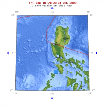
A magnitude-6.1 earthquake shook areas south of the Philippine capital Metro Manila Friday afternoon but caused no serious damages.
The quake struck at 2:23 p.m. local time(0623 GMT) and the epicenter was traced at the Mindoro Strait, with a depth of 50.1 kilometers, some 234 kilometers from the national capital, the United States Geological Survey said in a report.
Ismael Narag, an official of the Philippine Institute of Volcanology and Seismology, told local television that the quake was quite strong but because its epicenter was located between islands the damage to infrastructure is forecast to be light.
Narag said the quake might trigger some waves but not likely a tsunami.
Some residents in Mindoro and Luzon islands felt the jolt.
©Xinhuanet

Magnitude 6.0
Date-Time
* Friday, September 18, 2009 at 06:23:58 UTC
* Friday, September 18, 2009 at 02:23:58 PM at epicenter
Location 12.573°N, 120.469°E
Depth 50.1 km (31.1 miles)
Region MINDORO, PHILIPPINES
Distances 115 km (75 miles) SW of Calapan, Mindoro, Philippines
145 km (90 miles) SSW of Batangas, Luzon, Philippines
230 km (145 miles) SSW of MANILA, Philippines
250 km (155 miles) S of Olongapo, Luzon, Philippines


 Sterke aardbeving bij de Filipijnen


