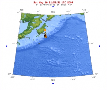
A SERIES of moderate earthquakes as strong as 5.9-magnitude have shaken the southern edge of the US state of Alaska off the coast of Kodiak Island.
The US Geological Survey reported the strongest quake struck at 6:22pm GMT (4.22am AEST) in the Gulf of Alaska about 98 km southeast of Kodiak, an island of about 14,000 people that serves as a popular eco-tourism destination. The temblor occurred at a depth of 12 km and about 560 km southwest of Alaska's largest city, Anchorage. Several quakes of magnitude 5.0 or higher rattled the region in the minutes and hours before the 5.9 quake.
There were no immediate reports of injuries or damage in the area from the "swarm" of more than two dozen earthquakes which occurred off Kodiak Island in recent days, an official at the USGS said. Earthquakes and volcanic activity are common in the area, which is part of the Ring of Fire, where the Pacific plate of the earth's crust meets other continental plates.
©The Daily Telegraph

Magnitude 5.9
Date-Time
* Saturday, May 16, 2009 at 18:22:39 UTC
* Saturday, May 16, 2009 at 10:22:39 AM at epicenter
Location 57.291°N, 152.416°W
Depth 70.5 km (43.8 miles) set by location program
Region KODIAK ISLAND REGION, ALASKA
Distances
38 km (24 miles) SSW (200°) from Chiniak, AK
47 km (29 miles) SSE (168°) from Womens Bay, AK
51 km (32 miles) S (174°) from Kodiak Station, AK
459 km (285 miles) SSW (200°) from Anchorage, AK


In het zuiden van Alaska hebben meerdere aardbevingen plaatsgevonden met een kracht van 5 tot 5,9 op de momentmagnitudeschaal. Dat meldt het Amerikaanse geologische instituut USGS.
De zwaarste aardbeving gebeurde om 20.22 uur Belgische tijd in de Golf van Alaska, op 98 km ten zuidoosten van het eiland Kodiak. De aardbeving gebeurde op een diepte van 12 km en werd voorafgegaan door meerdere schokken met een kracht van 5 of meer.
©Hln

 Serie aardbevingen in zuiden Alaska


