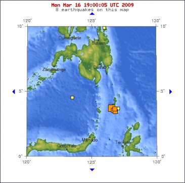
An earthquake measuring 6.3 on the Richter scale struck Monday evening off the northern tip of Indonesia's Sulawesi island, but there were no immediate reports of injury and damage, officials said. The quake at a depth of 35 kilometres near the Talaud islands between Sulawesi and the southern Philippines occurred at 9:16 pm (1416 GMT), the Indonesian Meteorology and Geophysics Agency said.
Officials said there were no immediate reports of injury or structural damage from the quake, another strong earthquake to hit the region in less than one month. A powerful 7.4-magnitude quake jolted the same area on February 12, injuring dozens of people and damaging hundreds of buildings.
©The Earth Times

Magnitude 6.3
Date-Time
* Monday, March 16, 2009 at 14:15:56 UTC
* Monday, March 16, 2009 at 10:15:56 PM at epicenter
Location 3.820°N, 126.500°E
Depth 35 km (21.7 miles) set by location program
Region KEPULAUAN TALAUD, INDONESIA
Distances
295 km (180 miles) SSE of General Santos, Mindanao, Philippines
315 km (195 miles) NE of Manado, Sulawesi, Indonesia
1335 km (830 miles) SSE of MANILA, Philippines
2460 km (1520 miles) ENE of JAKARTA, Java, Indonesia


 Krachtige aardbeving treft Indonesie


