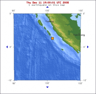
A 5.9 magnitude earthquake struck off the coast of the Indonesian island of Sumatra today, the US Geological Survey said, but there were no immediate reports of damage or casualties. The quake hit at six minutes after midnight (4.06am AEDT) today 167km west of Bengkulu on the island's south-west coast, at a depth of 40km, the USGS said.
The Pacific Tsunami Warning Centre in Hawaii said there was no risk of a major tsunami, but warned that there could be localised problems. There is a very small possibility of a local tsunami that could affect coasts located no more than 100km from the earthquake epicentre, said a warning on its website.
Authorities in the region near the epicentre should be made aware of this possibility.
©The Daily Mail

Magnitude 5.9
Date-Time
* Thursday, December 11, 2008 at 17:06:10 UTC
* Friday, December 12, 2008 at 12:06:10 AM at epicenter
Location 3.587°S, 100.778°E
Depth 35 km (21.7 miles) set by location program
Region KEPULAUAN MENTAWAI REGION, INDONESIA
Distances
165 km (105 miles) W of Bengkulu, Sumatra, Indonesia
295 km (185 miles) S of Padang, Sumatra, Indonesia
385 km (240 miles) SW of Jambi, Sumatra, Indonesia
720 km (445 miles) WNW of JAKARTA, Java, Indonesia


 Aardbeving van 5.9 treft de kust van Indonesië


