There are now three hurricanes in the Atlantic Basic for the first time since 2010.
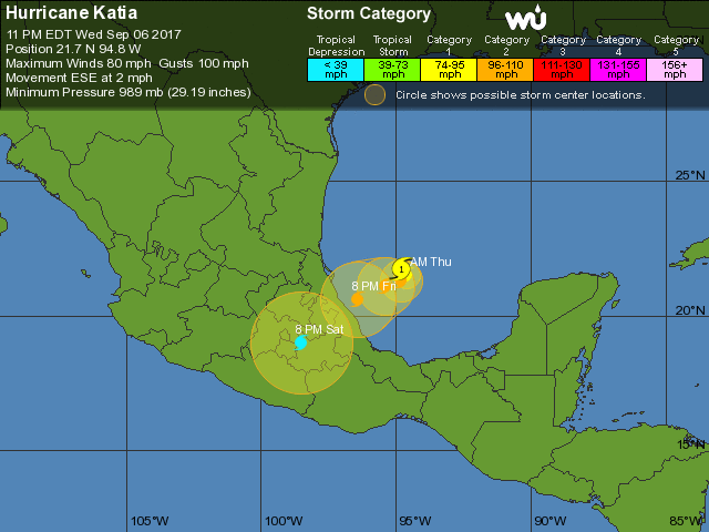
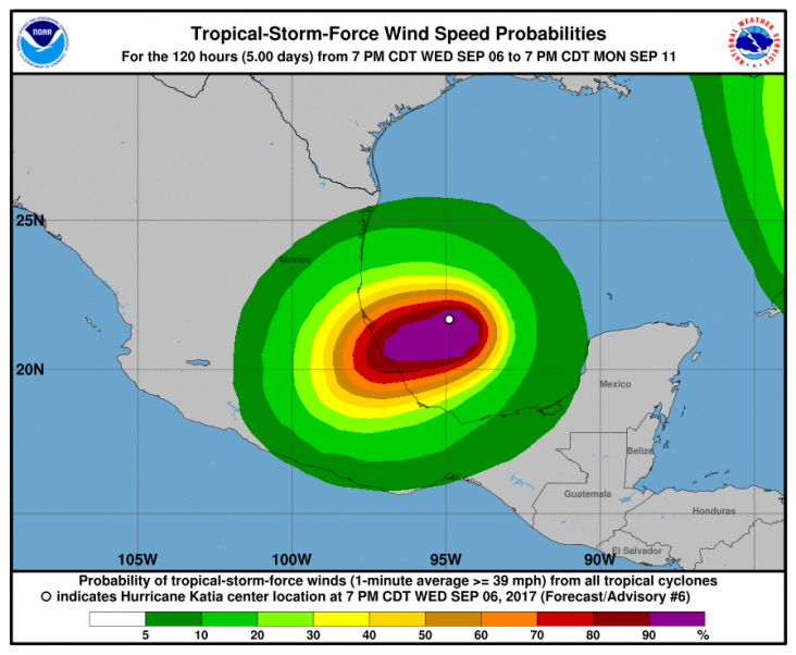
Katia has strengthened into a category 1 hurricane in the southwestern Gulf of Mexico, and could make landfall in eastern Mexico.
Irma is currently tearing through the Caribbean towards the Dominican Republic, having already brought death and destruction to Barbuda, Anguilles, Puerto Rico and the Virgin Islands.
The storm – the strongest of the three – is headed toward Florida where it could make landfall.
Jose is following in Irma's path, on track towards the Leeward islands.
Where is Tropical Storm Katia?
The latest NOAA advisory at 10am CDT puts Katia 210 miles east of Tampico, Mexico and about 190 miles north-north-east of Veracruz, Mexico.
A Hurricane Watch is in effect for Cabo Rojo to Laguna Verde.
The NOAA said: “Little overall motion is anticipated through late today, but then the hurricane is forecast to turn southwestward and approach the coast within the watch area late Friday or early Saturday.
“Although this area of the Gulf of Mexico is known for significant upwelling, Katia is a rather small tropical cyclone that shouldn't stir up as much cool water from below as most hurricanes would.”
Bron: http://www.express.co.uk/news/weather/850841/Tropical-Storm-Jose-path-Katia-Hurricane-Irma-update-map-models-NHC-NOAA-USA-Florida
Katia is op dit moment onderweg naar het oosten van Mexico en gaat daar vanavond landfall maken als een categorie 2 hurricane. Na veel wind aan de kust gaat er ook veel regen vallen wat voor overstromingen kan gaan zorgen.

Wunderground.com

Worldview | Gewijzigd: 10 september 2017, 10:12 uur, door Lako

 En wat doet orkaan Katia?


